
View of Tinker Cliffs from North Mountain Trail (April 2019)
VISITATION. Aside from day hikers, the North Mountain Trail currently hosts two main types of visitors.
- Mountain bikers know it as the Dragon’s Back and come from all over the East to ride it.
- Backpackers also come from all over to complete a loop that includes Virginia’s Triple Crown (Dragon’s Tooth, McAfee Knob and Tinker Cliffs) and the North Mountain Trail.
APRIL 2019 HIKE. Fellow RATC volunteer Susan Terwilliger and I met both kinds of visitors on our April 30, 2019 hike of North Mountain, with a helpful shuttle from Mark McClain. I had visions of a poorly maintained trail with lots of big trees blown down on the trail and a steady diet of rocks and steep ups and downs. I was wrong! This is a beautiful, very scenic trail with a good footbed for the the majority of its 12 miles or so. Only about 2 miles closest to Dragon’s Tooth is rocky and somewhat eroded. All of it is very well-signed.
We met at the Dragon’s Tooth parking lot and shuttled to the Andy Layne parking lot, so we could hike back to our cars. After crossing the paved road, we easily located the Forest Service kiosk describing the trail and began our upward climb of a little more than 2 miles. The trail was well maintained and follows Catawba Creek for about a mile. The creek has some lovely small waterfalls and would be a good water source in wetter months. There is no water once the trail leaves the creek.
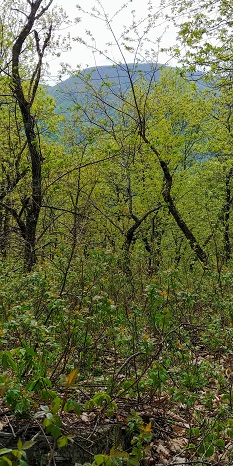
Turning left onto the North Mountain Trail at the top of the ridge, it is easy to follow your progress because there are three intersecting Forest Service trails with excellent new signage: Turkey Trail (about 5 miles into the hike), Grouse Trail (about 8 miles into it) and Deer Trail (about 9.5 miles into the hike). Although there is no water on the long ridge top, there are many unofficial campsites and, at least when the leaves are down, many outstanding views in both directions – looking towards the Catawba Valley and towards West Virginia.
Much of the land west of the ridge top is also in Jefferson National Forest, but some sections of the trail are quite narrow and some remains in private hands at the time of this writing. When you see red paint on the trees, you are seeing a Forest Service boundary.
The last 2 miles or so heading south are fairly rocky, with a somewhat steep and eroded descent to Va 311. Turn right at the bottom and walk a short distance along 311 to the Dragon’s Tooth parking lot entrance on your left. You are back!
We stopped for snacks twice and took a lot of photos and still completed the hike in just under 7 hours. Enjoy!