
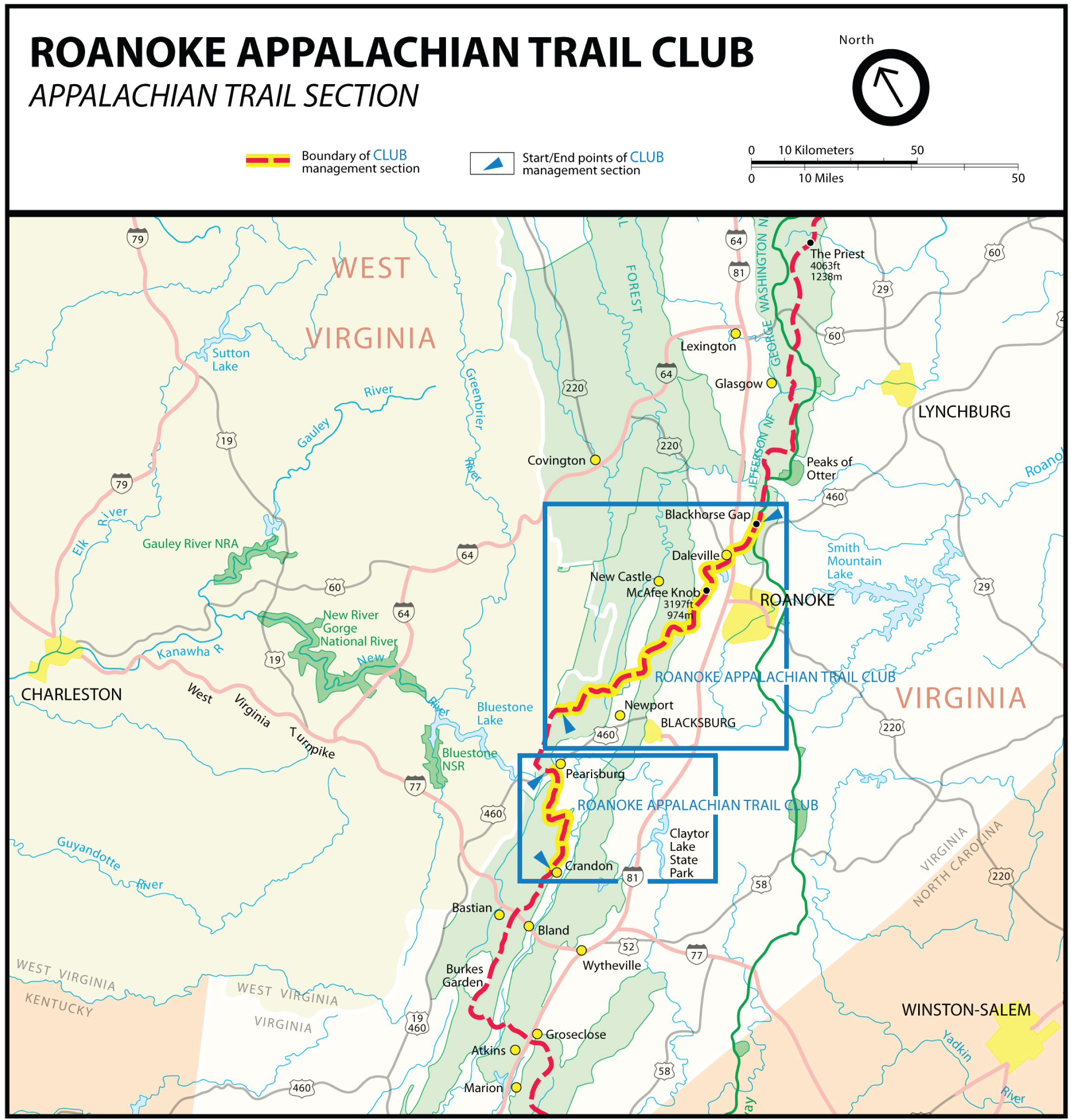
Our club’s goal is to provide the most accurate hiking-related information available on our AT section. See the map below for the specific section of the AT that our club maintains, a total of more than 120 miles.
In addition, as AT hikers ourselves, we’ve found the resources below helpful. If there is information you need that you are unable to find, please and we’ll get back to you as quickly as possible.
AT Hiking Resources
Appalachian Trail Hike Listing: a description of the 14 Appalachian Trail segments in our region along with driving instructions.
AT Distance Calculator – calculate the approximate walking distance in miles between two points along the Appalachian Trail using this tool.
Appalachian Trail Conservancy – Explore the Trail
Parking at trailheads on the Appalachian Trail
Map Resources
Interactive A.T. Map The National Park Service (NPS) provides an online, interactive map of the AT that is a good planning resource with information on distances, shelters, parking, etc.
Mountaineers Books Trail map sets and guidebooks available for purchase. Most of the 120 mile section of the A.T. that is maintained by the RATC is displayed on Central Virginia A.T. maps 3 and 4. The RATC-maintained hikes south of the New River (hikes 12, 13, and 14) are displayed on Southwest Virginia A.T. map 1.
FarOut Trail Guide Apps Maps of the entire AT for either Apple or Android smart phones. You purchase a section (almost all of the RATC section is southern half of Virginia – Damascus to Daleville), download it to your device, and you can find your current location even in Airplane mode or without a GPS signal. Includes elevation profile, trailheads, campsites, shelters, water sources and other waypoints. DOES NOT REPLACE PAPER MAPS OR COMPASS.
GPS File Depot Download maps compatible with your GPS device.
Jefferson National Forest map information Interactive online maps, map apps for download, and paper maps are available.
National Geographic Society online map store Trail and topographic maps available for purchase. Maps for the A.T. in Virginia, West Virginia, and Maryland are available as a map pack bundle. These maps show more of the area surrounding the trail than the ATC’s trail maps.
USGS Map Store Download USGS topographic maps