Here is a summary of the loop hike, beginning and ending at the Catawba Sustainability Center.
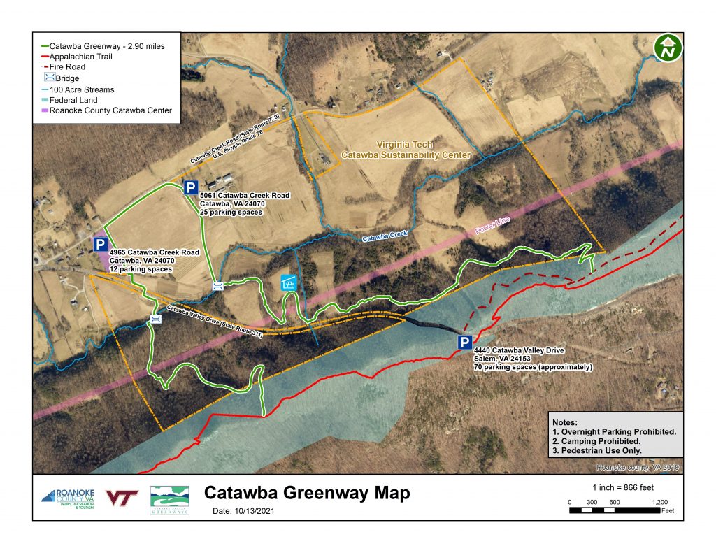
Mile 0.0 Park in CSC lot. Follow signs and orange blazes down entry road to begin your hike. Go around the first large gate if you can. If not, be sure to close it behind you – this is a working farm! The first portion is wheelchair-accessible, flat and then climbing along remains of old VA 311 paved road and grassy meadows to a picnic pavilion with nice view of Catawba Valley and North Mountain. Sights along the way on this experimental farm include a native warm season grass demonstration and an educational wetland on the right and a stream lab on the bridge over Catawba Creek.
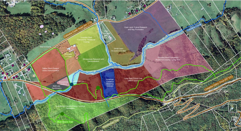
Mile 0.6 Picnic pavilion next to an American Chestnut breeding orchard. The trail leaves the old road and becomes a narrow footpath with a wooden stile and elaborate stairways, all built by local volunteers. Road noise fades away, and the woods are quiet. Emerge on the fire road that connects to the Appalachian Trail.
Mile 1.7 Turn left on the fire road and you will reach McAfee Knob in about 3.5 miles. Turn right to continue on the Catawba Greenway Loop. A detailed map of the McAfee Knob section of the AT is here.
Mile 1.8 Reach the intersection of the fire road and the AT. There is a chain across the fire road. Veer left and climb briefly. Stay right to continue southbound on the AT to the McAfee parking lot on VA 311. Follow the white blazes! Exercise extreme caution crossing VA 311. The speed limit is 55 mph, and this is a busy highway. Funding and plans are in place to build a pedestrian bridge in 2023-24.
Mile 2.1 Continue into the AT parking lot. On the lower left side of the lot, the AT southbound opening appears near some large rocks. Follow the signs and the white blazes.
Mile 2.7 Reach the intersection of the AT and the southern portion of the Catawba Greenway. Option: continue another 0.2 mi. south on the AT to the Sawtooth Ridge Overlook into Mason’s Cove and return to this point, adding another 0.4 mi. and a nice view to your hike. The short side trail to the Sawtooth Overlook is unmarked, but hard to miss. As you reach the crest of the ridge, look for a well-worn trail leading left toward large boulders. Turn left here, rather than following the white-blazed A.T. as it begins to descend. After enjoying the view, return to the junction with the Catawba Greenway the same way you came. Back on the Catawba Greenway, follow the orange blazes. Descend the mountain, cross a power line opening and the bridged Catawba Creek. Pass through a gate to cross VA 311. Pass through second gate on the other side. Please close the gates behind you! Follow the Catawba Greenway paralleling VA 311 and VA 779 through the Catawba Community Center (also a parking area for hikers) and back to the CSC parking lot.
Mile 4.0 Congratulations! You made it.