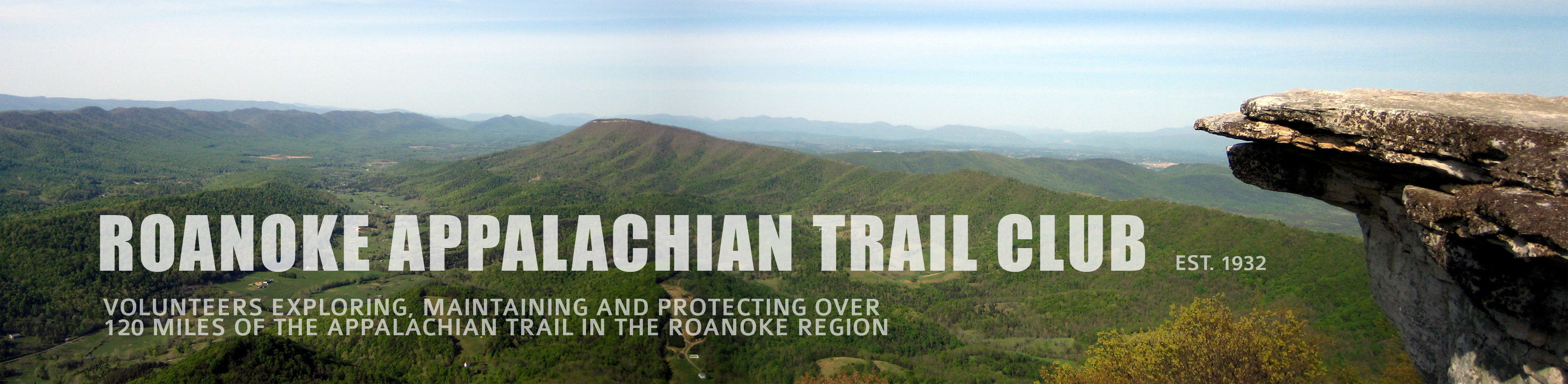
RATC’s 14 AT Hikes
The fourteen hikes listed here, shown from the northern end of the RATC’s AT section running south along the trail, include all 120+ miles of the Appalachian National Scenic Trail that the Roanoke Appalachian Trail Club (RATC) maintains. Beginning at Black Horse Gap on the Blue Ridge Parkway (BRP), the RATC section concludes at VA 611, south of Jenny Knob. The hikes are shown as day hikes and sometimes include trails (such as the Andy Layne Trail near Tinker Cliffs) that are not part of the Appalachian Trail (AT).
Click on the “Hike” link on the left side of the title to go to the description of the hike below. The description of each hike is followed by a zoomable map showing the trailhead locations for each end of the AT segment and the designated parking areas to best access the trailheads. Below the map are links to Google map driving directions for each end of the hike by way of the other end (for purposes of dropping off a shuttle vehicle for transportation at the end of the hike). The resulting driving directions map will require the entry of the drives origin.
Appalachian Trail Hikes |
||
|---|---|---|
| Hike Northern Point (hway / road) to Southern Point (hway / road) |
Length (miles) | Difficulty |
| Hike 1: Black Horse Gap (BRP) to Curry Gap (BRP) | 6.9 | Moderate |
| Hike 2: Curry Gap (BRP) to Daleville (US 220) | 9.4 | Strenuous |
| Hike 3: Daleville (US 220) to Andy Layne Trail (VA 779 / Catawba Road) | 13 | Strenuous |
| Hike 4: Andy Layne Trail (VA 779 / Catawba Road) to Catawba Mountain (VA 311) | 11.5 | Strenuous |
| Hike 5: Catawba Mountain (VA 311) to Dragon’s Tooth Parking | 8.9 | Strenuous |
| Hike 6: Trout Creek (VA 620 / Miller Cove Road) to Dragon Tooth Parking | 7 | Moderate |
| Hike 7: Lee Hollow (VA 621 / Upper Craigs Creek Road) to Trout Creek (VA 620 / Miller Cove Road) | 7.6 | Moderate |
| Hike 8: Sinking Creek (VA 630) to Lee Hollow (VA 621 / Upper Craigs Creek Road) | 10.4 | Strenuous |
| Hike 9: Johns Creek (VA 632 / Johns Creek Road) to Sinking Creek (VA 630) | 8.3 | Strenuous |
| Hike 10: Pine Swamp (VA 635 / Big Stony Creek Road) to Johns Creek (VA 632 / Johns Creek Road) | 13.2 | Strenuous |
| Hike 11: Big Horse Gap to New River (US 460) | 12.5 | Strenuous |
| Hike 12: Ribble Trail / AT Loop | 9.9 | Strenuous |
| Hike 13: Ribble Trail to Kimberling Creek (VA 606) | 5.5 | Moderate |
| Hike 14: Kimberling Creek (VA 606) to Jenny Knob (VA 611) | 9.3 | Strenuous |
Hike 1
| Black Horse Gap (BRP) to Curry Gap (BRP) | 6.9 miles | Moderate |
This hike is located in Botetourt County. From Black Horse Gap on the Blue Ridge Parkway, elevation 2,400 feet, the trail heads south with limited views. In 2.4 miles a blue blaze trail on right leads to the Wilson Creek Shelter. After crossing Wilson Creek, the trail ascends steeply. It then descends steadily and crosses Curry Creek. From there it ascends steeply on switchbacks to the Salt Pond Road road crossing. Go left on Salt Pond Road for 0.9 miles back to the Blue Ridge Parkway (BRP).
The Appalachian Trail is in blue
Google Map Driving Directions:
Hike 2
| Curry Gap (BRP) to Daleville (US 220) | 9.4 miles | Strenuous |
The hike is located in Botetourt County From Curry Gap on the BRP, the trail ascends on Salt Pond Road for 0.9 miles to the AT crossing. Go left on the AT (south). The trail follows the ridge line, with limited views to the valley below. At 3.7 miles the blue-blazed trail on left leads to Fullhardt Knob Shelter and the wooded summit of Fullhardt Knob. The trail then descends from Fullhardt Knob. There are a series of switchbacks near the bottom. At 6.7 miles the trail crosses Mountain Pass Road (VA 652). It then ascends an open knoll, with good views of McAfee Knob and Tinker Mountain, before descending and crossing US 11. The trail continues through mainly old orchards to US 220.
The Appalachian Trail is in blue
Google Map Driving Directions:
Hike 3
| Daleville (US 220 ) to Andy Layne Trail (VA 779 / Catawba Road) | 13 miles | Strenuous |
The hike is just north of Roanoke, starting in Daleville and ending in the Catawba Valley; it is strenuous whether hiked from north to south or south to north. Starting from the Park and Ride off Exit 150B of I-81 on US 220 near Daleville, follow the spur trail for 0.5 miles to pick up the AT. Cross a concrete bridge over Tinker Creek at 2.5 miles. Steep climb up Tinker Mountain is completed at 4.1 miles. The ridge walk brings some good views and passes under large power lines before reaching Hay Rock at 6.1 miles. Hay Rock is a massive fragment of tilted sandstone that forms the backbone of Tinker Ridge; a climb to the top provides fine views. The trail then runs along the ridge of Tinker Mountain with views to the left of Carvins Cove Reservoir, a huge conservation easement owned by the City of Roanoke. Cross Lamberts Meadow Spring (usually reliable water source – always treat water!)) and reach Lamberts Meadow Shelter at 9.5 miles. Ascend steeply to Scorched Earth Gap and intersect the Andy Lane Trail at 10 miles. Turn right onto the Andy Lane Trail (not part of the AT) and descend about 3 miles to the parking area.
The Appalachian Trail is in blue
Google Map Driving Directions:
Hike 4
| Catawba Mountain (VA 311) to Andy Layne Trail (VA 779 / Catawba Road) | 11.5 miles | Strenuous |
Please see the page McAfee Knob and the Triple Crown for more information about this very heavily-traveled section of the AT. Camping and campfires are highly restricted in this area. Parking can be very difficult on weekends between April and November. Early morning hikes are advised. This hike is described from south to north, offering the possibility of getting a shuttle and leaving vehicles at the small parking lot on the northern end. Be aware that the VA 311 Trailhead parking lot is temporarily closed while a pedestrian bridge is built and is expected to remain closed through 2024.
This hike offers the opportunity to see two of the prime vistas on the Appalachian Trail, McAfee Knob and Tinker Cliffs, in one day. The hike starts across from the large gravel AT crossing parking lot on VA 311. Be extremely careful crossing VA 311, visibility for cars is limited and they are moving very fast. The trail climbs gradually to McAfee’s Knob, passing John’s Spring Shelter at 1 mile and Catawba Mountain shelter at 3 miles. At 3.7 miles you’ll reach a short blue-blazed trail on left to McAfee Knob. The cliffs there offer magnificent views of the Catawba Valley and the city of Roanoke. The trail then follows the the ridge line to Tinker Cliffs at 8.6 miles, with views of McAfee Knob and North Mountain. Continue north on the AT for another half mile to Scorched Earth Gap. Go left on the Andy Layne Trail for 3-mile descent to VA 779 / Catawba Road.
The Appalachian Trail is in blue
Google Map Driving Directions:
- to Andy Layne Trail Parking via McAfee Knob Parking (temporarily closed)
- to McAfee Knob Parking (temporarily closed) via Andy Layne Trail Parking
If using Google maps, always use “McAfee Knob parking area” as the search term; other terms may take you to completely different locations.
Hike 5
| Catawba Mountain (VA 311 / Catawba Valley Drive) to Dragon’s Tooth Parking | 8.9 miles | Strenuous |
Please be aware that the VA 311 parking lot is temporarily closed while a pedestrian bridge is built, and is expected to remain closed through 2024. The hike begins at the VA 311 AT parking lot just 15 minutes from Roanoke. The AT is followed south over the many humps of Catawba Mountain before dropping down to the open fields of Beckner’s Gap. Between VA 785 / Catawba Road and VA 624 / Newport Road, the trail crosses Sandstone Ridge. Beyond VA 624 / Newport Road, the trail heads uphill past the Boy Scout Trail. It then reaches Rawie’s Rest, a knife-like rocky outcrop, with good views. Continue on to Lost Spectacles Gap, where a blue-blazed trail on right leads down to the Dragon’s Tooth parking lot.
The Appalachian Trail is in blue
Google Map Driving Directions:
- to McAfee Knob Parking (temporarily closed) via Dragon’s Tooth Parking
- to Dragon’s Tooth Parking via McAfee Knob Parking (temporarily closed)
If using Google maps, always use “McAfee Knob parking area” as the search term; other terms may take you to completely different locations.
Hike 6
| Dragon Tooth Parking to Trout Creek (VA 620 / Miller Cove Road) | 7 miles | Moderate |
Note: this hike is described from south to north because the RATC usually hikes it in that direction; the shuttle is much more convenient.
The hike is in Craig and Roanoke County west of Salem. After crossing Trout Creek, it ascends steeply through a fire recovery area, passing by the Pickle Branch Shelter at 1 mile. It then continues ascent to the ridge, and then goes around the crescent-shaped top of Cove Mountain to the blue blazed trail to Dragon’s Tooth on right. There are great views and rock-scrambling opportunities on Dragon’s Tooth. The trail descends on the AT to Lost Spectacles Gap, where a blue-blazed trail on left leads down to the Dragon’s Tooth parking lot.
The Appalachian Trail is in blue
Google Map Driving Directions:
- to Dragon’s Tooth Parking via Miller Cove Rd. Parking
- to Miller Cove Rd. Parking via Dragon’s Tooth Parking (Use these directions for the preferred hike)
If using Google maps, always using “Dragon’s Tooth parking area” as the search term; other terms may take you to completely different locations.
Hike 7
| Lee Hollow (VA 621 / Upper Craigs Creek Rd.) to Trout Creek (VA 620 / Miller Cove Rd.) | 7.6 miles | Moderate |
Located in Craig and a little bit of Roanoke County, the hike on Brush Mt. includes the Audie Murphy Monument, a tribute to the most decorated soldier of WWII, who died in a plane crash on the mountain in 1971. The hike starts with a 1,000 foot ascent of Brush Mountain via a series of switchbacks. At 3 miles the top of the mountain is reached and the trail continues along the crest of the mountain. At 3.8 miles, a short blue-blazed trail on left leads to the monument. There are good views of the Craig Creek Valley from here. At 5.9 miles the trail starts a steep descent to Trout Creek and VA 620 / Miller Cove Road.
The Appalachian Trail is in blue
Google Map Driving Directions:
- to Miller Cove Rd. Parking via Upper Craigs Creek Road Parking
- to Upper Craigs Creek Road Parking via Miller Cove Rd. Parking
Hike 8
| Sinking Creek (VA 630) to Lee Hollow (VA 621 / Upper Craigs Creek Road) | 10.4 miles | Strenuous |
Located in Craig County, the hike climbs up Sinking Creek Mountain, then follows the ridge where rock piles and old apple trees remain from the days when even the top of the mountain was farmed. Several slanted rocks offer views of Craig Creek Valley and the mountains beyond. The hike starts with a 1,200′ ascent of Sinking Creek Mountain. At 0.5 miles the trail passes the giant Keffer Oak, a very large historic tree. At 1.9 miles the ridge line of the mountain is reached. Most of the rest of the hike is along the crest of the mountain, with views of Craig Creek Valley to the right. At 9.5 miles pass the Niday Shelter and continue descent on trail to VA 621.
The Appalachian Trail is in blue
Google Map Driving Directions:
- to Upper Craigs Creek Road Parking via VA 632 Parking
- to VA 632 Parking via Upper Craigs Creek Road Parking
Hike 9
| Johns Creek (VA 632 / Johns Creek Road) to Sinking Creek (VA 630) | 8.3 miles | Strenuous |
The hike is located in Craig and Giles counties.
From Johns Creek Valley, the trail climbs steeply. At 2 miles it crosses route 601 at Rocky Gap. At 3.8 miles a blue blazed trail on right leads to Kelly Knob, with great views of the Sinking Creek Valley. The trail then descends, passing Laurel Creek Shelter at 5.1 miles. At 7.5 miles the trail crosses Route 42 in Sinking Creek Valley.
The Appalachian Trail is in blue
Google Map Driving Directions:
Hike 10
| Pine Swamp (VA 635 / Big Stony Creek Road) to Johns Creek (VA 632 / Johns Creek Road) | 13.2 miles | Strenuous |
The hike is located in Giles County.
From Stony Creek Valley the trail climbs 1,100 feet in one mile to the heavily wooded northern slope of Big Mountain. It passes the Bailey Gap Shelter at 3.6 miles. The trail then winds through the 11,172-acre Mountain Lake Wilderness. At 7.6 miles it passes Wind Rock on Potts Mountain, which provides the best view point of the hike. The trail passes War Spur Shelter at 12.4 miles.
The Appalachian Trail is in blue
Google Map Driving Directions:
- to Johns Creek Rd. Parking via Big Stony Creek Road Parking
- to Big Stony Creek Road Parking via Johns Creek Rd. Parking
Hike 11
| Pearis Cemetery (US 100) to Big Horse Gap | 11.6 miles | Strenuous |
This hike follows the AT north from Big Horse Gap near Dismal Falls in Giles County. It goes along the ridge line of Pearis Mountain. At 3.0 miles there is a rock cliff which provides good views of Sugar Run Mountain. The trail passes Doc’s Knob Shelter at 2.9 miles. At 8.1 miles there is another cliff, which provides good views of Wilburn Valley. Angel’s Rest is reached at 8.5 miles. This provides great views of the New River Valley and Peters Mountain. From there the trail descends towards Pearisburg. Turn right at the first paved road below Angel’s Rest (Va 793/Cross Avenue) if you want to walk into Pearisburg. Otherwise follow the AT as it traverses Bluff City and completes its descent at the Pearis Cemetery Parking, a dirt lot just off Va 100.
The Appalachian Trail is in blue
Google Map Driving Directions:
- to Big Horse Gap Parking via Pearis Cemetery Parking
- to Pearis Cemetery Parking via Big Horse Gap Parking
Hike 12
| Ribble Trail / AT Loop | 9.9 miles | Strenuous |
Located in Giles County, this hike follows Dismal Creek before a starting a steep climb up Sugar Run Mountain. The hike then follows the ridge line for several miles, offering views of the Wilburn and New River Valleys. The hike starts on the Ribble Trail for .4 miles to the AT. At the AT intersection, turn left (north). The trail crosses dismal Creek on footbridges several times in the next mile. At 1.9 miles the trail passes the Wapiti Shelter and then begins ascending Sugar Run Mountain. At 4.3 miles a rock outcrop provides excellent views of the valley below. At 6.5 miles, reach northern end of blue-blazed Ribble Trail. Make left onto the Ribble Trail and begin steep descent of the Ribble Trail, passing the old Honey Springs Cabin. The trail will cross FS 201 several times before reaching the parking area at 9.9 miles, where car is located.
The Appalachian Trail is in blue and the Ribble Trail is in orange.
Google Map Driving Directions:
(Note: The Ribble Trail parking area is located where road makes sharp left turn and begins to climb Sugar Run Mountain.)
Hike 13
| Ribble Trail to Kimberling Creek (VA 606) | 5.5 miles | Moderate |
Located in Giles County, this hike follows Dismal Creek for several miles. Much of the trail is lined with rhododendron. At 3.9 miles, blue-blazed trail on right goes 0.3 miles to Dismal Falls. This part of the creek is very scenic. The hike ends at VA 606 and Kimberling Creek. The AT goes over the creek on a footbridge. Note: the AT is in Blue and the Ribble Trail is in orange.
The Appalachian Trail is in Blue and the Ribble Trail is in orange.
Google Map Driving Directions:
- to Ribble Trail Parking via Kimberling Creek (VA 606) Parking
- to Kimberling Creek (VA 606) Parking via Ribble Trail Parking
(Note: The Ribble Trail parking area is located where road makes sharp left turn and begins to climb Sugar Run Mountain.)
Hike 14
| Kimberling Creek (Rt. 606) to Jenny Knob (Rt.611) | 9.3 miles | Strenuous |
The trail starts by crossing Kimberling Creek on a suspension footbridge. This is one of the longest footbridges on the AT. The trail then ascends steeply to the wooded summit of Brushy Mountain, before descending to Lickskillet Hollow. It then crosses VA 608 and again ascends Brushy Mountain. It passes Jenny Knob Shelter before reaching VA 611, the southern terminus of the section of the AT maintained by the RATC.
The Appalachian Trail is in blue
Google Map Driving Directions: